- Pilot Supplies Pilot Supplies
-
 Aviation Headsets & Accessories
- Aircraft Parts & Supplies Aircraft Parts & Supplies
-
 Aviation Books & Software
- Aviation Gifts Aviation Gifts
-
 Apparel & Sunglasses
- Disinfectants & Protective Equipment Disinfectants & Protective Equipment
-

Safe-Heet 700 Engine PreHeater
Safe-Heet$262.75700 Safe-Heet 700 Engine PreHeater EASY TO USE SAFE-HEET is a thin flexible pad that is bonded to the engine oil sump. The kit is complete with materials and step-by-step instructions. A log book entry is all that is required... -

Beechcraft Travel Air Checkmates
CheckMate$19.50Beechcraft Travel Air Checklists TRAVEL AIR 95 Travel Air 95 (Twin) TRAVEL AIR B95 Travel Air B95 (Twin) TRAVEL AIR D95A Travel Air B/D 95A (Twin) -

Beechcraft King Air Checkmates
CheckMate$28.10Beech King Air Checkmates King Air 200 (Two cards) King Air C90 (Two cards) -

-

Jeppesen Textbook - Aviation History
Jeppesen$73.9510001810-002, JS319008 Jeppesen Textbook - Aviation History (SOFTCOVER) The newly revised 2006 edition of Aviation History is an exciting full-color book that gives aviation enthusiasts a unique perspective on international... -

Beechcraft Baron Checkmates
CheckMate$19.50Beechcraft Baron Checklists BARON 55/A55 (Twin) BARON B 55 '64-'76 (Twin) BARON B 55 '77-'82 (Twin) BARON C/D/E 55 (Twin) BARON 56TC/A56TC (Twin) BARON 58 285 HP (Twin) BARON 58 300 HP (Twin) BARON 58p 310 HP (Twin) BARON 58p 325 HP (Twin) BARON 58TC... -

-

-

-

Beechcraft Musketeer Checkmates
CheckMate$17.20Beechcraft Musketeer Checklists MUSK23 Musketeer 23 MUSK-A Musketeer A23-24 (Super III) MUSK-B Musketeer B23 (Custom III) -

Beechcraft Debonair Checkmates
CheckMate$17.20Beechcraft Debonair Checklists DEBONAIR 33 DEBONAIR A/B 33 -

Beechcraft Bonanza Checkmates
CheckMate$17.20Beechcraft Bonanza Checklists BONANZA C/E 33 A BONANZA C/E/F 33 BONANZA F33 A BONANZA G33 BONANZA 35 BONANZA A/B 35 BONANZA C/D 35 BONANZA E35 BONANZA F35 BONANZA G35 BONANZA H35 BONANZA J/K/M 35 BONANZA N/P 35 BONANZA S35 BONANZA V35, V35 A/B BONANZA... -

Piper Navajo Checkmates
CheckMate$17.95Piper Navajo Checklists NAVAJO310 (Twin) NAVAJO350 Chieftan (Twin) -

-

Piper Aztec Checkmates
CheckMate$17.95Piper Aztec Checklists CM-AZTEC B (Twin) CM-AZTEC C-D (Twin) CM-AZTEC E (Twin) CM-AZTEC F (Twin) CM-AZTEC F TURBO (Twin) -

-

Piper Aerostar Checkmates
CheckMate$17.95Piper Aerostar Checkmate AEROSTAR Aerostar 600 (SN 715 & On) (Twin) -

Piper Malibu & Mirage Checkmates
CheckMate$17.25Piper Malibu & Mirage Checklists MALIBU (310) MIRAGE (350) MIRAGE W/AVIDYNE MALIBU MATRIX -

Piper Comanche Checkmates
CheckMate$14.85Piper Comanche Checklists CM-COM180 Comanche 180 CM-COM250/58-60 Comanche 250 '58-'60 CM-COM250 CARB61-64 Comanche 250 Carb. '61-'64 CM-COM250 FI Comanche 250 Fuel Inject. CM-COM260 FI Comanche 260 Fuel Inject. '65 CM-COM260B Comanche 260 B CM-COM260C... -

Piper Saratoga Checkmates
CheckMate$14.85Piper Saratoga Checklists SARAFG Saratoga (Fixed Gear) SARASP Saratoga SP SARAIIHP Saratoga II HP SARAIITC Saratoga II TC -

-

Piper Tri Pacer Checkmates
CheckMate$14.85Piper Tri Pacer Checkmates TRI PA 5-6 Tri Pacer 150/160 PACER 125/135 Pacer/Tri Pacer 125/135 -

-

-

-

-

CheckMate Cessna 350/400 Checklist
CheckMate$17.20CM-C350, CM-C400 CheckMate Cessna 350/400 Checklist One of the most popular aircraft checklist on the market today Everything on one card! Full color layout Emergency Procedures Received the FAA's Flight Safety... -

CheckMate Cessna 120-170 Checklist
CheckMate$14.85CM-C120-170 CheckMate Cessna 120-170 Checklist One of the most popular aircraft checklist on the market today Everything on one card! Full color layout Emergency Procedures Received the FAA's Flight Safety... -

CheckMate Piper Seminole Checklist
CheckMate$17.95CM-SEMINOLE CheckMate Piper Seminole Checklist One of the most popular aircraft checklist on the market today Everything on one card! Full color layout Emergency Procedures Received the FAA's Flight Safety... -

CheckMate Piper Cherokee Arrow Checklist
CheckMate$14.85CM-WARRIOR CheckMate Piper Cherokee WarriorChecklist One of the most popular aircraft checklist on the market today Everything on one card! Full color layout Emergency Procedures Received the FAA's Flight Safety... -

CheckMate Diamond Checklist
CheckMate$14.85 - $17.20CM-DIAMOND CheckMate Diamond Checklist One of the most popular aircraft checklist on the market today Everything on one card! Full color layout Emergency Procedures Received the FAA's Flight Safety... -

CheckMate Piper Cherokee Warrior Checklist
CheckMate$14.85CM-WARRIOR CheckMate Piper Cherokee WarriorChecklist One of the most popular aircraft checklist on the market today Everything on one card! Full color layout Emergency Procedures Received the FAA's Flight Safety... -

CheckMate Piper Cherokee Checklist
CheckMate$14.85CM-PC CheckMate Piper Cherokee Checklist One of the most popular aircraft checklist on the market today Everything on one card! Full color layout Emergency Procedures Received the FAA's Flight Safety Award -

CheckMate Cessna 172 Checklist
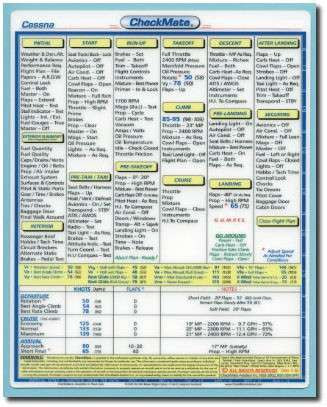
CheckMate$14.85 - $17.20CM-C172/172A CheckMate Cessna 172 Checklist One of the most popular aircraft checklist on the market today Everything on one card! Full color layout Emergency Procedures Received the FAA's Flight Safety Award -

Pilot's Manual: Access to Flight (eBundle)
ASA$61.20Author Aviation Theory Centre & Paul Craig ISBNs 978-1-56027-734-7 978-1-56027-836-8 Integrated Private and Instrument Curriculum. The most efficient way to train for your personal transportation... -

Instrument Flying Handbook (eBundle)
ASA$18.00FAA-H-8083-15B reprint. Primary reference text for the Instrument Rating FAA Knowledge Exam. Softcover book + eBook PDF Download In Full... -

ASA Flight School eKit
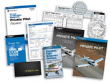
ASA$179.95asa-pm-ekit ASA Flight School eKit ASA eKits provide the trusted, time-tested ground school books in an eBook format, supported with the pilot supplies a student pilot needs to complete training—all at an exceptional value. The Private Pilot... -

Ace the Technical Pilot Interview
McGraw-Hill$29.95TA139609-8 Ace the Technical Pilot Interview by Gary V. Bristow. A comprehensive study guide providing pilots the answers they need to excel on their technical interview. * Features nearly 1000 potential questions (and answers) that may be asked... -

Clarity Aloft Microphone Cover
Clarity Aloft$6.00Replacement Microphone Cover for Clarity Aloft headsets -

Mobilgrease 28
Mobil$17.89$16.85mg28T Mobilgrease 28 Mobilgrease 28 is a supreme performance, high temperature, antiwear grease combining the unique features of a polyalphaolefin (PAO) synthetic base fluid with an organo-clay (non-soap) thickener. The wax-free nature of...

